Examples
Runs
View on GitHubA small run tracker: a live map that follows the route as it is recorded, big numbers for time, distance and pace, a history of past runs, and a detail screen with per-kilometre splits and a GPX export shared through the system share sheet. A simulated route stands in for the GPS in development and in the screenshots below.
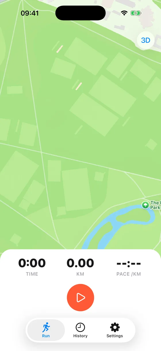
Run, iOS, light 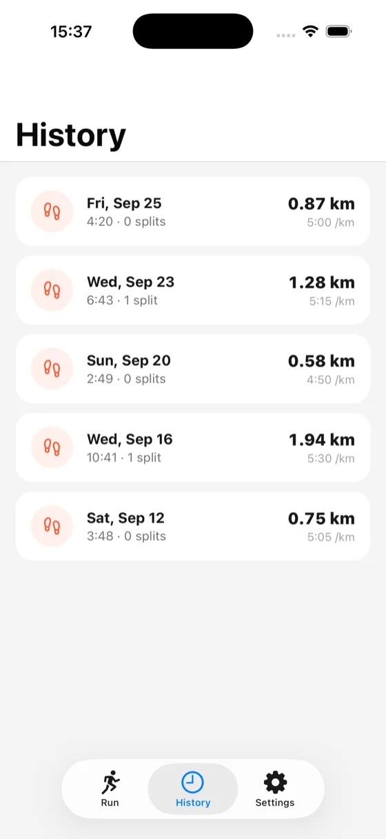
History, iOS, light 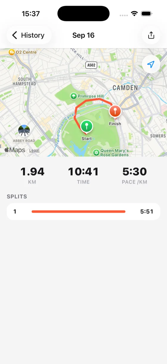
Run detail, iOS, light 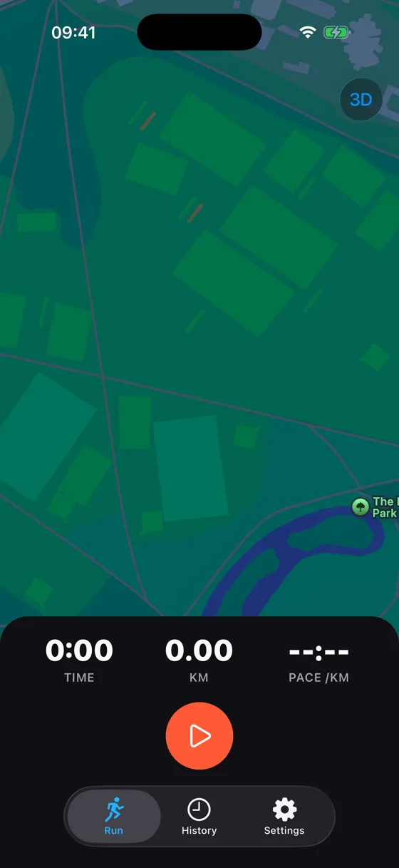
Run, iOS, dark 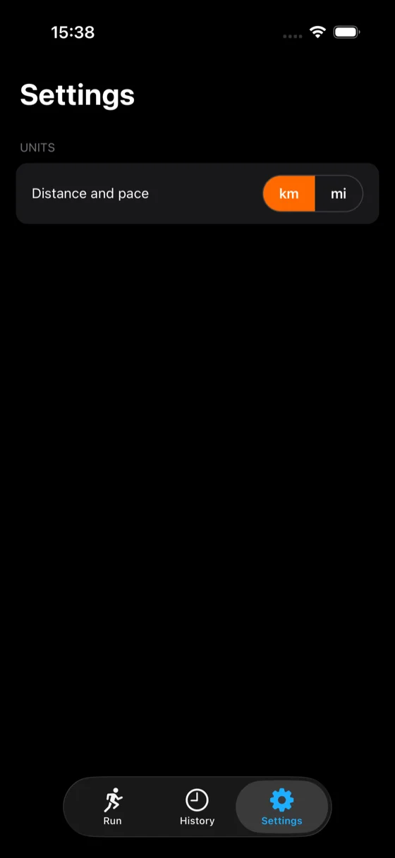
Settings, iOS, dark
What it shows
- MapsThe Run and detail screens draw the route as a live polyline on Apple's map.
- LocationDistance, pace and splits are all worked out from a position signal.
- PermissionsLocation access is asked for on the Run screen, with a denied state handled.
- Keep awakeThe screen stays on for as long as a run is recording, and no longer.
- File systemA finished run is written to a GPX file before it is shared.
- SharingA run's GPX export opens the system share sheet.
- StorageKilometres or miles is remembered between launches.
- Native tabsRun, History and Settings, each a UITabBarController tab.
- Native stackA run pushes onto the stack with its own native header and back button.
- Icons@ng-icons/lucide, drawn as native shapes for every icon in the app.
Run it
Clone the repository and start the app with Expo. Press i for the iOS simulator, a for the Android emulator, or scan the code with Expo Go.
git clone https://github.com/ng-native/ng-native.gitcd angular-native && pnpm installcd examples/runs && pnpm startThe code
Every file in the app, as it is in the repository.
src/app/run/run.tsOn GitHub
import { Component, DestroyRef, computed, effect, inject, viewChild } from '@angular/core';
import { provideIcons } from '@ng-icons/core';
import { lucidePause, lucidePlay, lucideSquare } from '@ng-icons/lucide';
import { NgIcon } from '@ng-native/icons';
import { ColorScheme } from '@ng-native/device';
import { KeepAwake } from '@ng-native/expo/keep-awake';
import { Location } from '@ng-native/expo/location';
import { Pressable, Text, View } from '@ng-native/components';
import { NativeNavigation, TabSafeAreaView } from '@ng-native/router';
import { MapView, type MapMarker, type MapPolyline } from '@ng-native/expo/map-view';
import { LocationSourceSetting } from '../settings/location-source-setting.ts';
import { Units } from '../settings/units.ts';
import { Tracking } from '../tracking/tracking.ts';
import { SIMULATED_ROUTE } from '../tracking/simulated-route.ts';
import {
  convertDistance,
  convertPace,
  formatDistance,
  formatDuration,
  formatPace,
} from '../tracking/geo.ts';

const ROUTE_COLOUR = '#ff5a36';
/** Where the map opens before the first fix arrives: the simulated route's own start. */
const START = SIMULATED_ROUTE[0]!;

/**
 * The live run: a map that follows the route as it is recorded, big numbers for time, distance
 * and pace, and start/pause/finish controls. Keeps the screen awake while recording, and shows a
 * denied state instead of the map when location access has not been granted.
 */
@Component({
  selector: 'app-run',
  imports: [MapView, NgIcon, Pressable, TabSafeAreaView, Text, View],
  providers: [provideIcons({ lucidePause, lucidePlay, lucideSquare })],
  template: `
    <view class="screen">
      <expo-map
        class="map"
        [markers]="markers()"
        [polylines]="polylines()"
        [cameraPosition]="cameraPosition()"
        [uiSettings]="mapUiSettings"
      />

      @if (needsLocationPermission()) {
        <view class="permission-overlay">
          <view class="permission-card">
            <text class="permission-title">Location access needed</text>
            <text class="permission-body"
              >Runs uses your location to track your route, distance and pace while you run.</text
            >
            <pressable
              class="permission-button"
              accessibilityRole="button"
              (press)="requestLocation()"
            >
              <text class="permission-button-label">Allow location</text>
            </pressable>
          </view>
        </view>
      }

      <!--
        The panel paints to the very bottom of the screen, behind the tab bar, and its content
        stops where the bar begins. tab-safe-area-view takes the bar's height from the tab screen
        itself, as a margin, which the panel grows around. A safe-area-view cannot: its insets come
        from the app's root provider, which sits above the tab bar and knows only the home
        indicator, and its padding leaves the map showing through the inset.
      -->
      <view class="panel absolute bottom-0 inset-x-0">
        <tab-safe-area-view class="panel-content" [edges]="['bottom']">
          <view class="stats">
            <view class="stat">
              <text class="stat-value" testID="elapsed">{{ elapsedLabel() }}</text>
              <text class="stat-label">Time</text>
            </view>
            <view class="stat">
              <text class="stat-value" testID="distance">{{ distanceLabel() }}</text>
              <text class="stat-label" testID="unit">{{ unitLabel() }}</text>
            </view>
            <view class="stat">
              <text class="stat-value" testID="pace">{{ paceLabel() }}</text>
              <text class="stat-label">Pace /{{ unit() }}</text>
            </view>
          </view>

          <view class="controls">
            @switch (status()) {
              @case ('idle') {
                <pressable
                  class="control"
                  accessibilityRole="button"
                  accessibilityLabel="Start run"
                  (press)="startRun()"
                >
                  <ng-icon name="lucidePlay" size="28" color="#ffffff" />
                </pressable>
              }
              @case ('recording') {
                <pressable
                  class="control secondary"
                  accessibilityRole="button"
                  accessibilityLabel="Pause run"
                  (press)="pauseRun()"
                >
                  <ng-icon name="lucidePause" size="22" [color]="onSurfaceColor()" />
                </pressable>
                <pressable
                  class="control stop"
                  accessibilityRole="button"
                  accessibilityLabel="Finish run"
                  (press)="finishRun()"
                >
                  <ng-icon name="lucideSquare" size="20" color="#ffffff" />
                </pressable>
              }
              @case ('paused') {
                <pressable
                  class="control secondary"
                  accessibilityRole="button"
                  accessibilityLabel="Resume run"
                  (press)="resumeRun()"
                >
                  <ng-icon name="lucidePlay" size="22" [color]="onSurfaceColor()" />
                </pressable>
                <pressable
                  class="control stop"
                  accessibilityRole="button"
                  accessibilityLabel="Finish run"
                  (press)="finishRun()"
                >
                  <ng-icon name="lucideSquare" size="20" color="#ffffff" />
                </pressable>
              }
            }
          </view>
        </tab-safe-area-view>
      </view>
    </view>
  `,
  styleUrl: './run.css',
})
export class Run {
  private readonly tracking = inject(Tracking);
  private readonly location = inject(Location);
  private readonly locationSetting = inject(LocationSourceSetting);
  private readonly units = inject(Units);
  private readonly keepAwake = inject(KeepAwake);
  private readonly navigation = inject(NativeNavigation);
  private readonly colorScheme = inject(ColorScheme);

  private readonly map = viewChild(MapView);

  protected readonly mapUiSettings = { myLocationButtonEnabled: false, compassEnabled: false };

  protected readonly status = this.tracking.status;
  // The secondary control's background flips light/dark with the theme (`run.css`), so its icon
  // has to as well - `NgIcon`'s colour is drawn straight into the SVG, not something CSS reaches.
  protected readonly onSurfaceColor = computed(() =>
    this.colorScheme.current() === 'dark' ? '#fafafa' : '#18181b',
  );
  protected readonly unit = computed(() => this.units.unit());
  protected readonly unitLabel = computed(() => (this.unit() === 'km' ? 'km' : 'mi'));

  protected readonly elapsedLabel = computed(() => formatDuration(this.tracking.elapsedSeconds()));
  protected readonly distanceLabel = computed(() =>
    formatDistance(convertDistance(this.tracking.distanceMeters(), this.unit())),
  );
  protected readonly paceLabel = computed(() =>
    formatPace(convertPace(this.tracking.paceSecondsPerKm(), this.unit())),
  );

  protected readonly needsLocationPermission = computed(
    () => !this.locationSetting.simulate() && !this.location.permission.granted(),
  );

  protected readonly route = computed(() =>
    this.tracking
      .route()
      .map((point) => ({ latitude: point.latitude, longitude: point.longitude })),
  );
  protected readonly polylines = computed<readonly MapPolyline[]>(() => {
    const coordinates = this.route();
    return coordinates.length < 2 ? [] : [{ coordinates, color: ROUTE_COLOUR, width: 5 }];
  });
  protected readonly markers = computed<readonly MapMarker[]>(() => {
    const route = this.route();
    const current = route.at(-1);
    return current ? [{ id: 'current', coordinates: current, tintColor: ROUTE_COLOUR }] : [];
  });
  protected readonly cameraPosition = computed(() => {
    const current = this.route().at(-1) ?? START;
    return { coordinates: current, zoom: 16 };
  });

  constructor() {
    // Follows the runner as new fixes arrive, while there is a map to move.
    effect(() => {
      const position = this.cameraPosition();
      void this.map()?.setCameraPosition(position);
    });

    // Held only while actually recording: paused or idle, the screen may sleep like any other.
    effect((onCleanup) => {
      if (this.status() !== 'recording') return;
      const release = this.keepAwake.hold('run-recording');
      onCleanup(release);
    });

    inject(DestroyRef).onDestroy(() => {
      if (this.status() !== 'idle') this.tracking.discard();
    });
  }

  protected startRun(): void {
    this.tracking.start();
  }

  protected pauseRun(): void {
    this.tracking.pause();
  }

  protected resumeRun(): void {
    this.tracking.resume();
  }

  protected finishRun(): void {
    const run = this.tracking.finish();
    if (run) void this.navigation.push(['/runs', run.id]);
  }

  protected async requestLocation(): Promise<void> {
    await this.location.permission.ensure();
  }
}